Journal
Reading the Coral Coves masterplan
Thirteen residence types, a shoreline and a rising contour. How the Coral Coves plan is organised, and what the elevation numbers on it tell you.
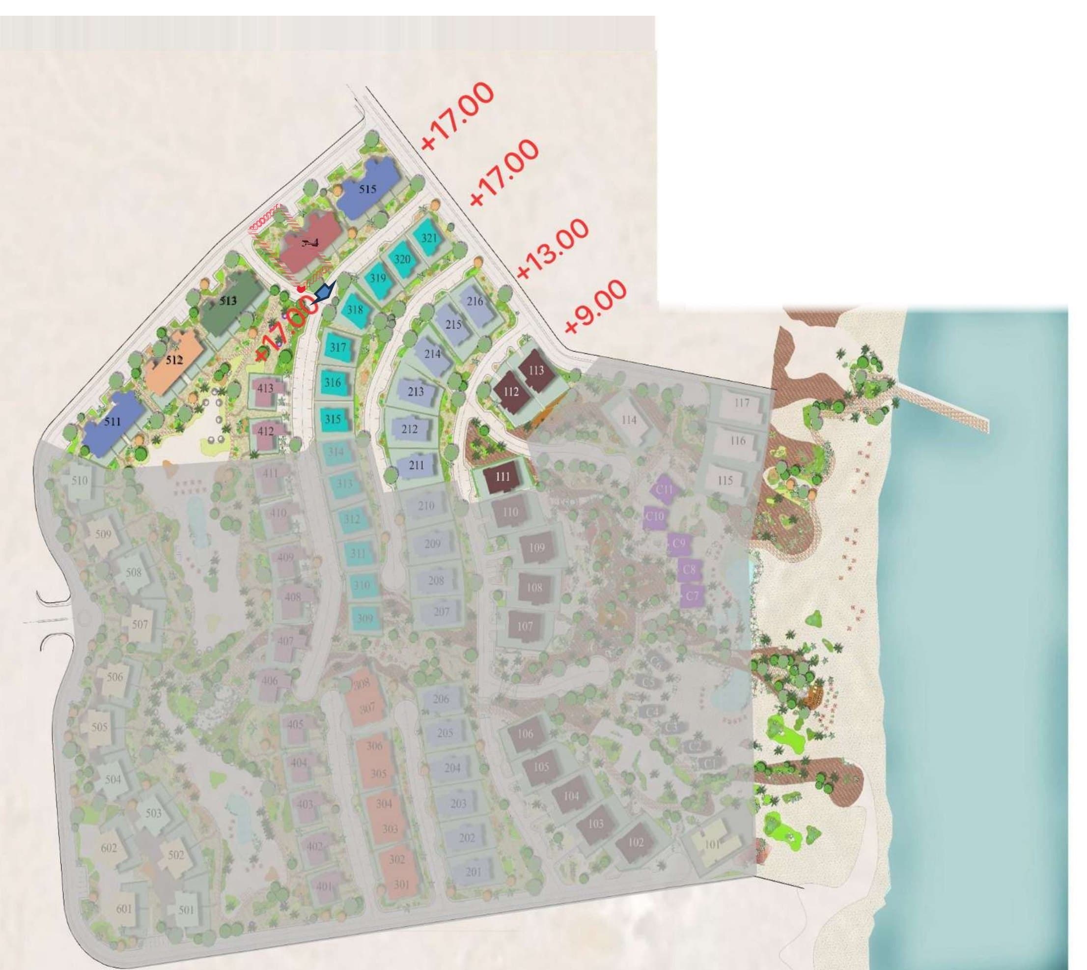
The Coral Coves masterplan organises thirteen residence types across a site that rises from the Red Sea shoreline to about seventeen metres above sea level. Reading it well tells you most of what you need to know about view, privacy and price before you look at a single floor plan.
The contour is the structure
Spot elevations on the plan run +9.00, +13.00 and +17.00 metres as you move inland. The scheme steps back up that gradient rather than cutting into it, which is what the brochure means by architecture that “follows the rhythm of the landscape”. In practice, higher rows look over the roofs of lower ones to open water.
Thirteen types, four families
The legend groups into villas — Grand, Cove, Dunes and Reef — chalets in twin, standalone and terrace configurations, cabanas in single and grand, and six apartment buildings numbered B1 to B6. Coral Apartments B6 is the building currently released, sitting in the upper cluster.
Type placement is not random. Cabanas and beachfront chalets take the shoreline edge; apartment buildings occupy the middle terraces; villas take the highest and widest plots.
What to ask before you commit
Ask for the unit's spot elevation and the height of whatever sits directly seaward of it. Ask which side the terrace faces — the B6 plans place terraces off the living room, so orientation determines whether you get morning or afternoon sun on it. And ask what is scheduled to be built in the plot in front, and when.
This article is written from the Coral Coves project documents supplied by Somabay. These figures are examples and can change — check the current terms with Soma Estatesbefore contracting.